Introduction
Last May (2013) with a friend I spent a weekend in the Ogliastra province in Sardinia, we have chosen this area because apart from sea, it offers also numerous trekkings, amongst them the famous “Selvaggio blu” (wild blue trek).
The latter is a challenging path 50 km long that takes many days walk, and runs through inlets, coves and mule tracks from Pedra Longa to Cala Sisine. We have travelled individually just few stages, otherwise is necessary to turn to a local guide, as it is very difficult to orient yourself and because of the scarsity of water.
Useful Links
Are you looking for informations about Wild Blue Trek?
COOPERATIVA GOLORITZE
Cooperative company of local guides that organizes excursions, day trips, climbs and obviously the wild blue trek “Selvaggio blu”. Furthermore, here you can find a mountain lodge with bedrooms and restaurant that I strongly suggest!
TURISMO OGLIASTRA
Official site of Ogliastra tourism.
Where to sleep
We have chosen for our accomodation to rent a flat on the website homeaway.com , where it is possible to find different solution according to your needs.
The village where we slept was called Santa Maria Navarrese, chosen because of its comfortable location near the paths leading to Baunei's beaches and also because it has a very beautiful seaside location with all the services needed. On the websites listed above it is possible to choose other accomodations, ranging from "Agriturismi" (farm holidays) to B&B.
Itinerary
1° Day: Santa Maria Navarrese
We arrived at Cagliari airport with a Ryanair flight and we retired the car we have rented on the website AUTOEUROPE , that I have been using for years and I find it really good.
Taking the SS125 we arrived at Santa Maria in a few hours, waiting for us there was the landlord for the deliver of the keys. We left our luggages and we went right away searching for a place to feed our stomach and we choose the restaurant “Lungomare” near the harbour.
Lunch was ok and the view over the sea was beautiful, the owner has been really kind, as generally all the people that we have met in these area. To help our digestion we went for a walk up to Pedra Longa, an rock obelisc towering 120 metres above the sea.. The path starts not far from the village centre, nearby the hostel “Bellavista”, crossing a wooden gate (it has to be reclosed) and in about 1h 30 minutes reaches Pedra Longa, 4,5 km from the beginning.
This short path is a sample of what the “Selvaggio blu” of Baunei has to offer, walks in the wild green amongst arbutus and juniper, rocks overlooking the sea and small coves bathed by intense blue water. For dinner we have chosen to eat a pizza at the restaurant “Il pozzo”, nice place and good pizza.
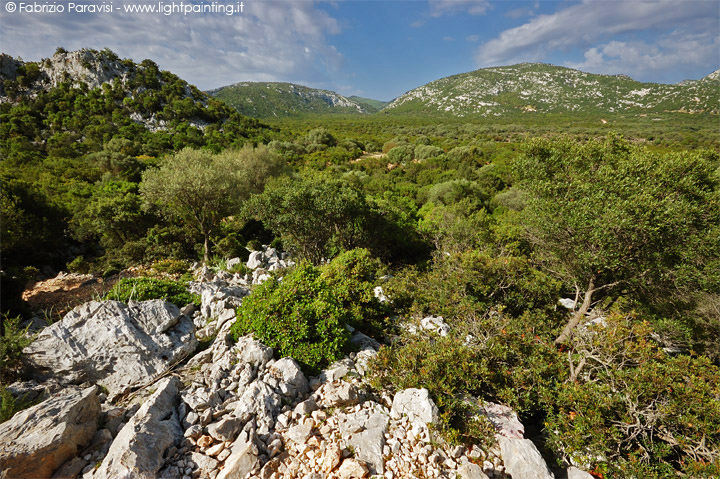
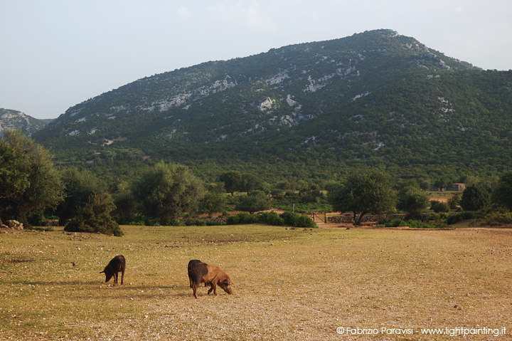
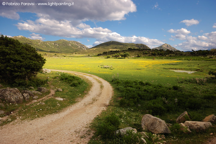
mediterranean maquis in Supramonte
2° Day: Altopiano del Golgo and Cala Goloritze
After breakfast we left towards Baunei, to reach the Golgo tableland from where numerous trekking paths start. It is a wild valley of basaltic origin, enclosed by a series of limestone ramparts, covered by thick vegetation of holly oaks, junipers e mediterranean maquis.
To reach the Golgo take the road that from the centre of Baunei climbs in direction of “San Pietro Golgo”. After a serie of bends is reached “Supramonte”; the road follows the ancient “Bia Maore” (main road), enters in a wood of centenary holly oaks and after 7 km arrives at the tableland. Our aim of the day was Cala Goloritze, taking the path that starts nearby the bar “Su Purteddu”. To reach this local, leave the paved road described earlier and turn right at the “Cala Goloritze” sign, up to the parking place where it is possible to leave the car for 4€ the all day.
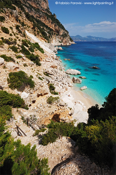
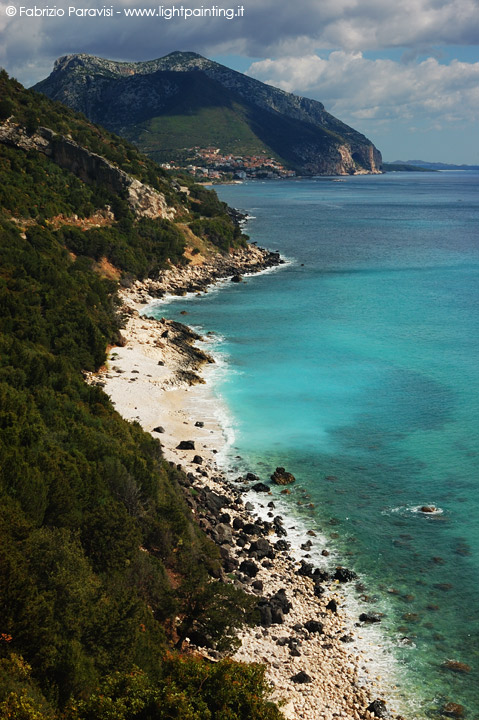
The path is quite simple and very well maintained, the beach is reached in about 1h 30 minutes. It is better to use trekking sturdy shoes, slippers and flip-flops are to be avoided. There is no water supply so it is advisable to buy food and drinks before departure. The first landmark visible nearby the sea is the famous “Aguglia di Goloritzè”, a limestone obelisc 147 metres high, destination for many enthusiasts that retrace the steps (or fingerprints) of the early climbers: the great Maurizio Zanolla “Manolo” and Alessandro Gogna which opened, in 1981, the trace “Sinfonia dei mulini a vento” (Windmills' symphony).
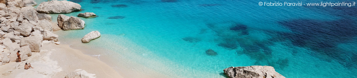
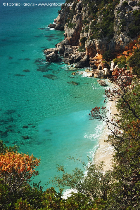
The beach is marvellous, in my opinion one of the most beautiful of Sardinia, its water is intense blue coloured and it is surrounded by a wild and pristine environment. Being a small cove, it is best to visit this place in spring when is not crowded with bathers and in addition to that, without the summer heat the trekking is far easier..
-
Cala Goloritzè vista dal sentiero
-
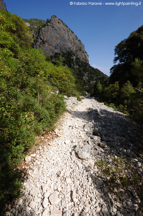
Sentiero per Cala Goloritze
-
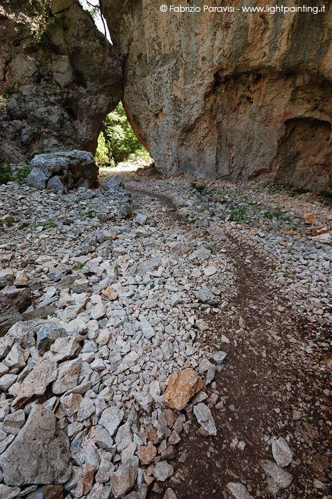
Sentiero per Cala Goloritze
-
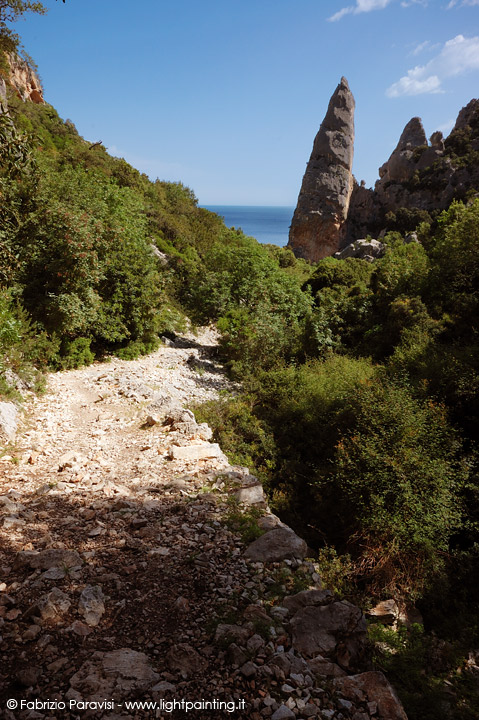
La famosa Aguglia
-
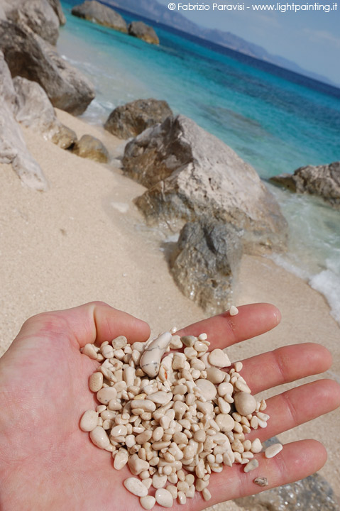
I ciottoli della spiaggia
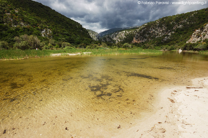
We came back to the bar “Su Purteddu” in the late afternoon where we enjoyed few beers while we were waiting for dinner time. We visited the San Pietro church, near which there is the natural monument “Su Sterru”, a chasm in the plateau, believed to be one of the deepest amongst the single aisle kind in Europe.
Once we arrived at the Cooperative we met Antonio Cabras, a competent local guide, that suggested us to visit thereabout, the famous “faccia litica” or otherwise known as “the giant of mount Tumbulu ”, a very particular rock resembling to a face. The Dinner was great: a selection of cured meat, culurgiones and malloreddus (typical sardinian dishes), roasted piglet. All of this accompanied by a very good local red wine.
-
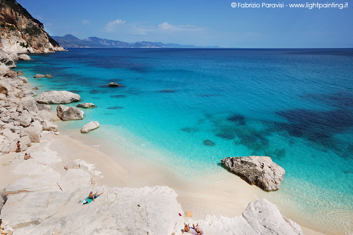
Cala Goloritzè
-
Panorama del Golgo
-
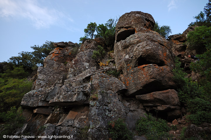
La famosa faccia litica
-
"Su Scalone"
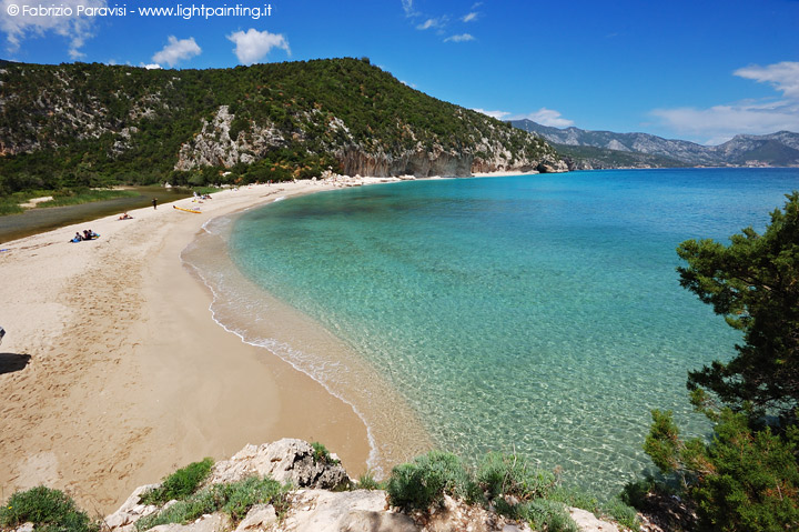
Cala Luna
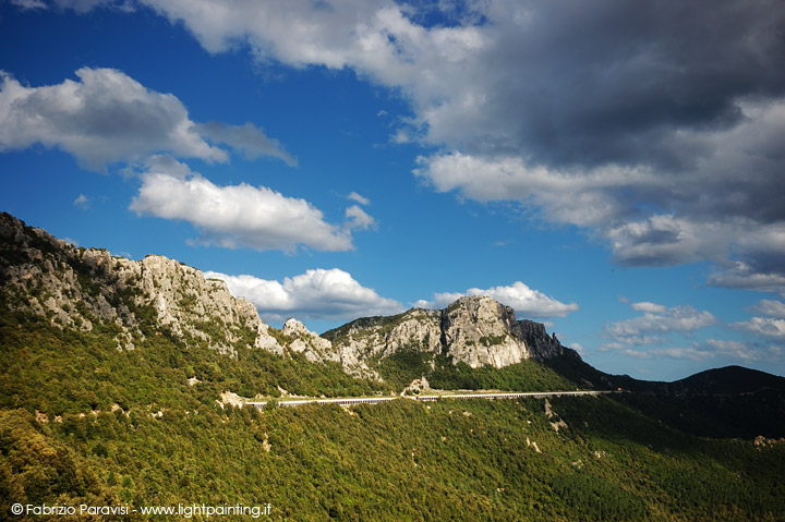
The following day we decided to visit Cala Luna, walking along the path that starts from Cala Fuili. By car we reached Dorgali from Baunei on the SS125, driving through the Supramonte so-called “montano”, because this stretch of road enters inland and it allows to admire isolated and wild landscapes that characterize the area.
The road straddles some mountain passes and then descends towards the sea, it turns right in direction of Cala Gonone and then follow the signs on the right for Cala Fuili where the road ends and park the car on the side. To find the starting point of the path it is needed go down the steps for Cala Fuili, cross it and keep going straight in the mediterranean maquis. A series of green signs indicate the path, in any case well evident.
-

Il Supramonte
-
Panorama verso Cala Gonone
-
Cala Fuili
After twenty minutes of walk there is a crossroads that takes to “Grotta del Bue Marino”, in reach within 15 minutes, instead we kept walking straight, the path continues rather flat along the seaside, even though it is hidden by the vegetation.
Approaching to Cala Luna the path drops steeply (Codula di Luna) even though without any particular danger, it is anyway advisable to wear trekking shoes. Once arrived at the riverbed, we crossed it and followed towards the sea on the opposite site. We walked beside a restaurant/bar and crossed a little wooden bridge and finally reached the destination, after 2 hours and 30 minutes.
The beach is enchanting, behind it a small lake surrounded by a rich vegetation has formed, from whom departs a river that goes across it and then flows into the sea. The eroded rock has formed numerous grottoes that can be visited on foot, walking northbound along the beach, there are also many climbing routes all over the surrounding walls. There is a little harbour where dock the boats that navigate the route Cala Luna-Cala Gonone, useful for people that do not want to trek. The price for this service is around 10€ each way.
Being sunday the beach was crowded but not packed, for sure springtime is the best period to visit these inlets, when they are not yet invaded by summer turism.
-
Cala Luna
-
Il fiume che scorre di fianco alla spiaggia
-
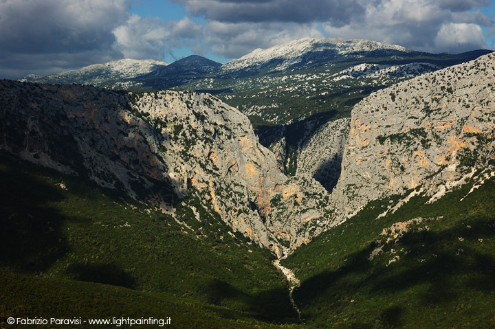
Le Gole di Su Gorropu
-
Il Supramonte
-
La strada che porta a Baunei
Later we took our way back to the car, where we regained the road to Santa Maria Navarrese. Along the road that ascends to Supramonte is visible on the right side the famous “Gole di Su Gorropu", a deep canyon (over 500 mt high) reachable on foot along a curvy path 12 km long. In the evening for dinner we came back to the restaurant “Lungomare”, where we also stayed after our meal, to drink a few beer “Ichnusa” with the owner and some local guys.
Cagliari
The next day we left for the airport to catch our plane. Along the way we stopped in some little coves in Costa Rei and later we made a rapid visit to the old city centre of Cagliari.
-
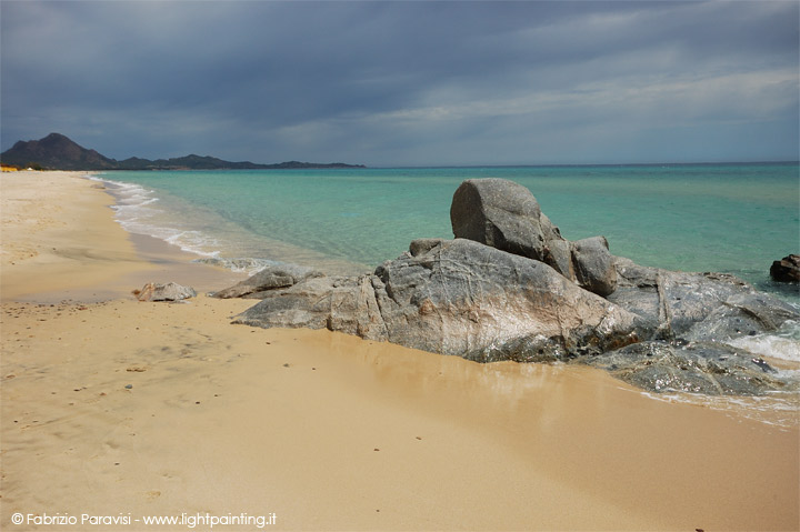
La spiaggia di Costa Rei
-
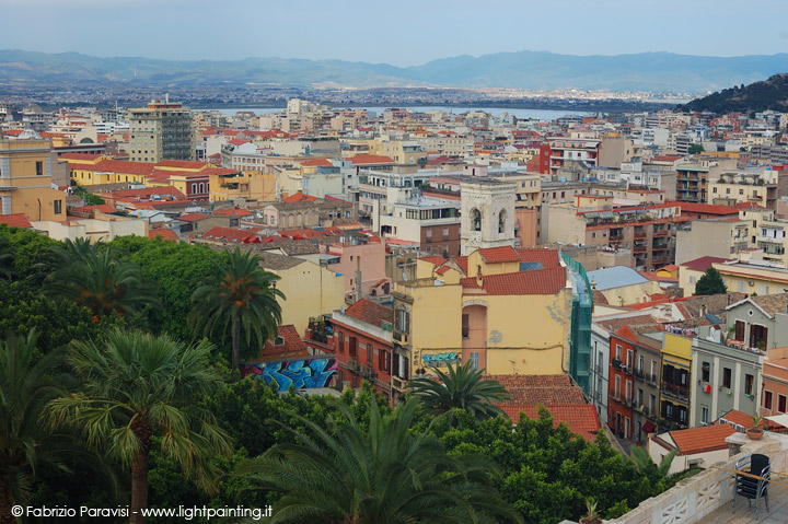
Cagliari
Have you got any suggestions or updates?
If you have updates about services, costs, or other useful informations SEND ME AN E-MAIL!